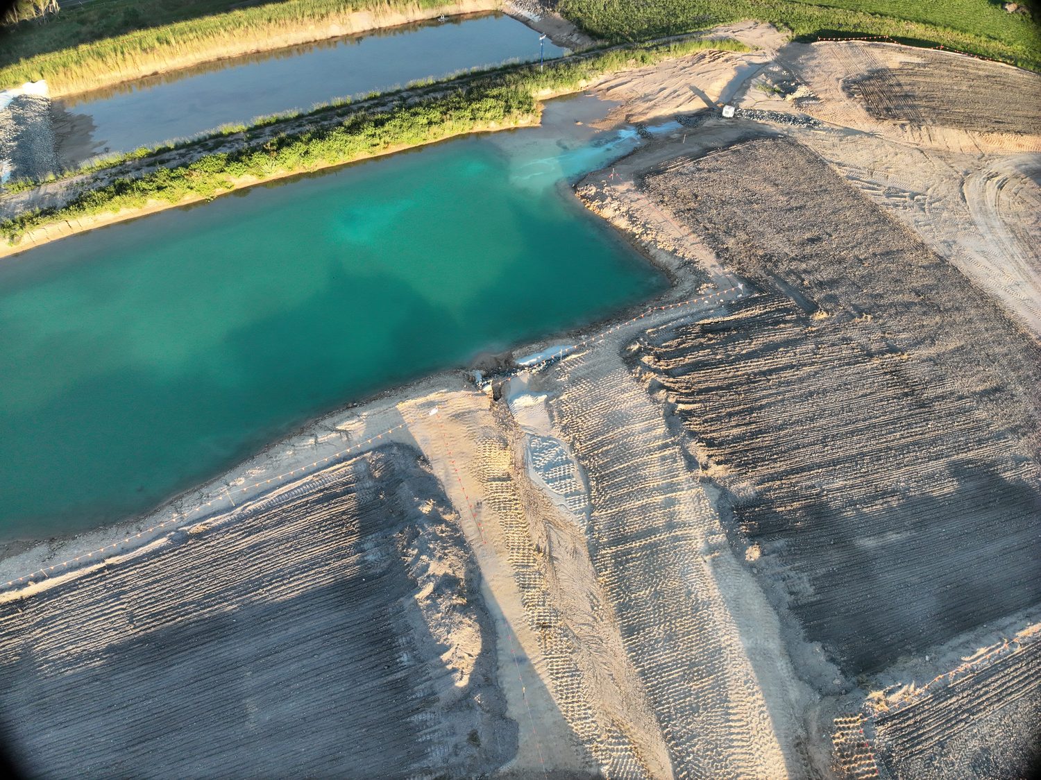
Drone surveying in Brisbane
RTK-controlled photogrammetry for civil and structural teams: contours, surfaces, volumes and LOD 400 digital twins, flown by the operator who scoped the job.
Drone surveying in Brisbane means RTK-controlled aerial photogrammetry, flown to an accuracy target agreed before capture. What comes back is CAD-ready: contours, surfaces, orthomosaics, volumes, or a measurable 3D model. Hover holds CASA ReOC #9398 and $28M public liability, and works controlled airspace across the metro area. Indicative pricing, reviewed August 2026 and exclusive of GST — a topographic site survey roughly $800–$3,500, a volumetric stockpile survey around $500–$2,000 a visit, a validated LOD 400 digital twin of one structure from about $1,000. Absolute accuracy is up to 1 cm + 1 ppm horizontal and 1.5 cm + 1 ppm vertical, with 3–5 mm relative on structures. Quotes come back in writing, fixed, within one business day.
What a drone survey gives a Brisbane design team
A drone survey replaces the slow part of site pickup. Rather than a crew walking a grid, the site is flown in a controlled photogrammetric pattern against ground control marked and observed on the day. The imagery then becomes the surfaces your design team actually opens: an orthomosaic, contours at whatever interval you specify, a digital terrain or surface model, CAD-ready line work, and volumes where the job calls for them. On a typical development site that is one morning instead of several days — and nobody spends those days walking live plant or unstable batters.
Hover is a single-operator practice. Harry Billing scopes, flies and processes every job, so the person who answers a question about the data is the person who captured it. The capture is photogrammetry, not LiDAR: a deliberate choice, because a textured model can be inspected as well as measured. Where an asset needs that inspectable record rather than a ground surface, the same flight becomes a LOD 400 digital twin.
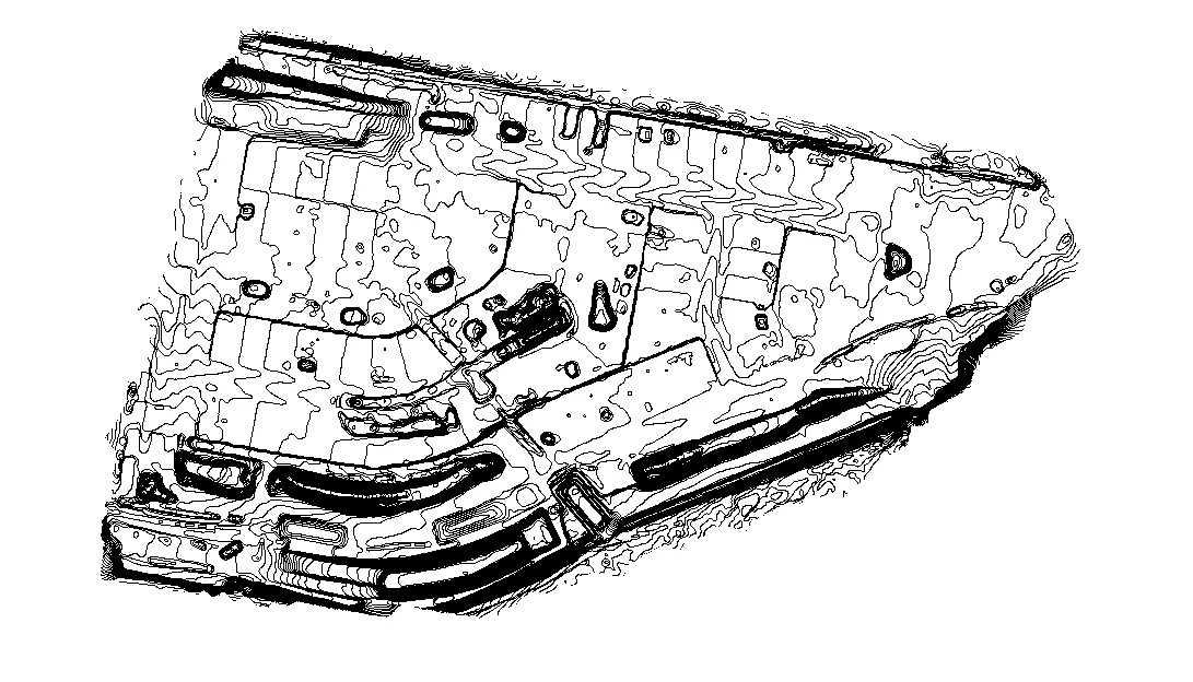 CONTOUR DELIVERABLE
The numbers, stated plainly
| Absolute accuracy, horizontal | UP TO 1 CM + 1 PPM |
|---|---|
| Absolute accuracy, vertical | UP TO 1.5 CM + 1 PPM |
| Relative accuracy on structures | 3–5 MM |
| Capture method | RTK PHOTOGRAMMETRY · NO LIDAR |
| Ground control | SITE-DEPENDENT · MIN 3 CONTROL + 2 CHECK |
| Accuracy record | SURVEY QUALITY REPORT |
| Quote turnaround | ONE BUSINESS DAY |
Ground control is laid to suit the site rather than to a fixed recipe: a minimum of three control points and two independent check points, with more added as size and layout require. The check points are held out of the bundle adjustment, so the accuracy figure reported back is a real check rather than a self-graded one.
Three ways a Brisbane survey gets scoped
Topographic site survey
RTK topographic site surveys deliver contours, a DTM or DEM, an orthomosaic and CAD-ready line work for civil design, earthworks and tender packages. Roughly $800–$3,500 ex GST.
Volumetric survey
Stockpile and cut-and-fill volumetrics are measured against a true ground surface and repeat month to month without shutting the site down. Around $500–$2,000 a visit.
Digital twin capture
Photogrammetry and digital twins produce a validated LOD 400 model of a structure: point cloud, textured mesh and measurable geometry for BIM and remediation planning. From about $1,000.
Most jobs are one of those three. Where a survey and an asset inspection are wanted in the same mobilisation they are scoped together, which is covered under drone inspections across Brisbane. Sites outside South East Queensland are quoted as a single fixed price for a scheduled regional QLD or Northern NSW job.
Which survey do you actually need?
Two things get called a survey and it matters which one the job wants. Anything touching a boundary or a title — cadastral work, boundary definition, a plan that gets lodged — is legal survey work under the Queensland Surveyors Act 2003, and it has to come from a registered surveying practice. Hover is not one, and says so. What Hover produces is the engineering and pre-design layer that sits alongside that: the ground surface, the volumes, the model. Where a project needs both, flag it early and the cadastral side gets referred to someone who can sign it.
From enquiry to data
- 01
Scope and fixed quote
Send the site and the deliverable. A scoped method, control plan and written fixed price come back within one business day, direct from Harry.
- 02
Airspace and site paperwork
Controlled-airspace authorisation is arranged under CASA ReOC #9398, and SWMS and proof of $28M public liability go across before anyone mobilises.
- 03
Ground control, then capture
Control and check points are marked and observed to suit the site, then the flight runs to the agreed pattern and overlap.
- 04
Processing and the accuracy check
Deliverables are built in your formats, with a Survey Quality Report recording the control laid and the accuracy achieved against the agreed target.
- 05
If it misses, we fix it
If the data falls short of the target set in the proposal, ground control is re-marked and the aerotriangulation re-run. If that still misses, the site is re-flown at no cost. That remedy is standing.
Brisbane airspace, sorted before mobilisation
A large share of greater Brisbane sits inside controlled or restricted airspace, and the CBD and inner suburbs are squarely in it. Two authorisation paths exist, and what separates them is lead time. Routine city work goes through the automated airspace authorisation service, which clears in near real time and is open to ReOC holders only. Anything non-standard — above 120 m, over people, inside restricted airspace — needs a CASA Form 101-09 lodged at least 60 days out. Neither is a blocker. Both are planning items, and they only turn into problems when nobody raises them early.
Brisbane is home base, so the Gold Coast and Sunshine Coast are routine local mobilisations rather than travel jobs. For the wider operating area, see Brisbane & SEQ and regional QLD & Northern NSW.
Straight answers, before you ask
Q/01How much does a drone survey cost in Brisbane?
There is no fixed price list, because the number is driven by the site, the access and the deliverable. Indicative 2026 bands, all excluding GST: expect roughly $800 to $3,500 for a topographic site survey, $500 to $2,000 a visit for stockpile volumetrics, and from about $1,000 for a validated LOD 400 digital twin of a single structure. Controlled-airspace work in the CBD takes more planning than an open greenfield site, and that shows up in the quote. Send the site and the deliverable, and a written fixed price comes back within one business day.
Q/02How accurate is a drone survey compared to a ground survey?
Absolute accuracy is up to 1 cm + 1 ppm horizontal and 1.5 cm + 1 ppm vertical against the ground control laid on the day, with 3 to 5 mm relative accuracy on structures. That is engineering and pre-design grade. The target itself is set per job and written into the proposal before anyone flies, rather than assessed afterwards, and the figures achieved come back in a Survey Quality Report.
Q/03Can a drone survey replace a registered surveyor?
No, and Hover does not claim otherwise. Boundary definition, cadastral work and title matters are legal survey work under the Queensland Surveyors Act 2003, and they belong with a registered surveying practice. What Hover delivers is engineering and pre-design data: contours, surfaces, orthomosaics, volumes and 3D models. Where a project needs both, the cadastral component is referred out.
Q/04Do you need CASA approval to fly a survey in Brisbane?
For most of the metro area, yes. The certification that matters is CASA ReOC #9398, because that is what opens the automated airspace authorisation service, the near-real-time path for routine city work. Flights above 120 m, over people or inside restricted airspace sit outside that path and need a CASA Form 101-09 lodged at least 60 days ahead. Raise those at scoping rather than the week before and they stay a diary entry instead of a delay.
Q/05What do I actually receive at the end?
The deliverable set is agreed before capture. It typically covers an orthomosaic, contours, a digital terrain or surface model, CAD-ready line work, cut-and-fill or stockpile volumes and a textured 3D model, in whatever mix the job calls for. Everything arrives in the formats your design team already works in, alongside a Survey Quality Report recording the ground control laid and the accuracy achieved.
There is more detail on pricing in the Brisbane drone survey cost guide, which breaks down the five factors that move the number.
Scope this for your site
Send the site boundary and what the data has to support. Harry scopes it and prices it himself, in writing, with the capture method attached.
HARRY BILLING — CHIEF REMOTE PILOT
0411 445 458
[email protected]
CASA ReOC #9398 · $28M PUBLIC LIABILITY