The short answer
Drone-based AI crack detection replaces the slowest part of a concrete inspection, which is getting eyes close enough to every face, and leaves the judgement where it was. A drone flies a planned pattern at close range to the structure. A segmentation model works through every frame and marks the pixels it thinks are cracks. Those marks are projected onto a 3D model built from the same photographs, so each crack has a position on the structure. Then a person reviews every one before a report is issued.
Done properly, the output is a register of verified findings an engineer can filter, open and sign off. Done badly, it's a pile of red lines with no positions and too many stains in it.
Why 0.2 mm is the number that matters
Australian practice cares about cracks well under a millimetre wide. Queensland's Structures Inspection Manual classes concrete cracks as hairline up to 0.1 mm, minor from 0.1 to 0.3 mm, moderate from 0.3 to 0.6 mm and severe above 0.6 mm, and it's explicit that the actual crack width should be measured, not the spalled edge around it.
VicRoads' technical note on cracks in concrete puts the corrosion threshold in the same range. Under normal exposure, surface cracks narrower than 0.3 mm pose no threat to the reinforcement; in highly aggressive environments the safe limit is 0.2 mm or less; and on bridge decks, even cracks of 0.1 to 0.2 mm may become significant for long-term durability.
Set against those bands, 0.2 mm sits in the middle of what an inspector records as minor, and at the limit one road agency treats as safe in highly aggressive exposure. A method that can only see cracks from 0.3 mm records nothing in the minor band at all.
How AI crack detection works
Capture. The structure is flown on a planned pattern at a fixed standoff, so every face is imaged at a known resolution with enough overlap to rebuild it in 3D. Light matters as much as distance: shadowed soffits and raking afternoon sun change what a camera can resolve, so the capture window is planned as carefully as the standoff.
Detection. Most current systems use semantic segmentation, in which a neural network labels every pixel as crack or not crack. The architectures are well established: U-Net, the DeepLab family and transformer models such as SegFormer. A bounding-box detector can say there's a crack somewhere inside a rectangle; a segmentation mask traces the crack itself, which is what you need for a length, a path and a position.
Geolocation. The same photographs are processed into a photogrammetric model, and each detection is projected from its image onto that model. That's the step that turns a red line in a photograph into a crack on a particular member, at a particular position, that can be found again at the next inspection.
Verification. A person reviews every detection against the full-resolution frame before the register is issued. Of the four steps, this is the one that decides whether the register can be trusted.
Detection is not measurement
Ground sample distance (GSD) is the width of surface one pixel covers. It falls straight out of the camera geometry: GSD equals sensor width multiplied by the distance to the surface, divided by the product of the focal length and the image width in pixels. Halve the distance, or double the focal length, and the GSD halves.
A crack narrower than a pixel can still be detected, because it darkens the pixels it crosses. The model matters too: in a 2018 study of concrete crack images, a deep convolutional network detected cracks wider than 0.08 mm, or 0.04 mm in transfer-learning mode, against 0.1 mm for the best traditional edge detector. Measuring a crack's width is a different problem, because the crack has to span several pixels. A 2022 drone study of concrete bridge cracks took three pixels across a crack as the practical floor and reported width errors of around 1 mm at a GSD of about 1 mm, in line with the pixel size.
| Ground sample distance | Narrowest crack spanning three pixels |
|---|---|
| 0.1 mm per pixel | 0.3 mm |
| 0.2 mm per pixel | 0.6 mm |
| 0.3 mm per pixel | 0.9 mm |
| 0.5 mm per pixel | 1.5 mm |
| 1.0 mm per pixel | 3.0 mm |
The table is a rule of thumb: the three-pixel floor worked through at each GSD. It's also why a 0.2 mm figure should be read as a detection threshold, not as the precision of a width measurement. Where an exact width matters, for a crack being monitored or a repair being specified, the register tells you precisely where to put a crack gauge.
Why the AI over-reports, and why that's deliberate
Concrete is full of things that look like cracks to a computer: water staining, efflorescence, formwork lines, construction joints, shadows and paint edges. Curated datasets flatter models; real inspection imagery doesn't. On dacl10k, a benchmark of 9,920 images from real bridge inspections, the best model in the 2024 study reached a mean intersection-over-union of 0.42 across damage classes, and 0.286 on cracks. Those are respectable research results, and nowhere near good enough to hand straight to an asset owner.
So the sensible setting is to over-report: tune the model to miss as little as possible, accept that it will flag stains and shadows, and remove them by hand. Human inspection has its own scatter, too. A US Federal Highway Administration study of routine visual bridge inspection found that only 68 per cent of condition ratings fell within one rating point of the average. Systematic capture and human review don't remove the need for judgement; they give it complete, consistent evidence to work from.
What drone imagery can't tell you
A camera sees surfaces. It can't tell you how deep a crack runs, whether it's still moving, whether the concrete behind a sound-looking face has delaminated, or how far the reinforcement has corroded under the cover. Depth needs a core or ultrasonic testing. Delamination needs hammer sounding. Reinforcement condition needs cover-meter and half-cell work, or a break-out. Whether a crack is active needs repeat measurement over time.
All of that is why the drone goes first. A register of verified surface findings shows where the slower, hands-on tests are worth doing, so they aren't placed by guesswork.
From pixels to a register you can use
A useful deliverable has three layers. First, a geolocated PDF report anyone can open on a phone at the asset, with each finding's photos, location and description. Second, the 3D model behind it, for whoever needs to measure. Third, a register in CSV or GIS form, so findings can go straight into an asset system and be compared against the next cycle.
Keep three numbers apart when you read any provider's claims, ours included. Ground sample distance is how much surface one pixel covers, and at close standoff it's sub-millimetre. The detection threshold is the narrowest crack found, 0.2 mm in our trial. Relative accuracy is how well the model's geometry holds together, up to 3–5 mm on structures. They measure different things and should not be blended into one headline figure.
Hover's 0.2 mm trial at Tingalpa
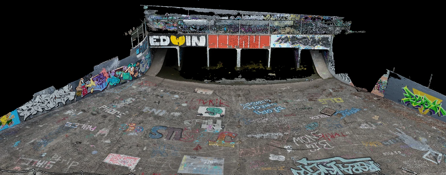
The 0.2 mm we quote was established in a controlled capability trial: a concrete culvert under the M1 at Tingalpa, captured at fine GSD to find the smallest crack the workflow would pick up. Cracking from 0.2 mm was detected. It was a trial, not a client job.
What it establishes is that the capture can resolve cracks of that width under controlled conditions. What it doesn't establish is that every capture will, regardless of standoff and light. That's why each job's flight plan is designed to hold the resolution on the structure in front of it, and why the AI defect detection service quotes the figure with its conditions attached.
Flying it in Queensland
Close-range inspection flying is commercial work under CASA rules, and the operator's certificate matters. We fly under CASA ReOC #9398. Much of greater Brisbane sits in controlled airspace: routine work there clears through the automated airspace authorisation service, which only ReOC holders can use, while flights over people, above 120 m or inside restricted airspace need a CASA Form 101-09 lodged at least 60 days ahead. Rail corridors add the owner's possession and protection requirements, as on our close visual inspection of the Indooroopilly Rail Bridge. Inspection capture is daylight-only, because fine surface detail depends on even light. The wider compliance picture is in our guide to CASA drone regulations for infrastructure work.
Ten questions to ask any provider
- What's the smallest crack you've demonstrated, on what surface, and at what standoff and GSD?
- Is that a detection threshold or a width measurement?
- Who reviews the detections before I see them, and what gets discarded?
- How is each finding located: on a 3D model, by the aircraft's position, or only in a photo?
- What exactly will I receive, and can my team open it without your software?
- Will the next inspection capture the same faces the same way, so the registers can be compared?
- What can't your method see on this structure, and what would you recommend instead?
- What relative accuracy does the model hold, and how is it checked?
- Which CASA operator's certificate do you hold, and which airspace path does my site need?
- How long do you keep the raw imagery, in case a finding needs re-examining?
A provider should be able to answer every one of those in specifics.
What it costs
Pricing is scoped on the asset: its size, access, the surface area to analyse and how the register needs to be delivered. As a 2026 guide, exclusive of GST, a single-structure inspection with AI defect reporting starts in the low four figures. A close visual inspection without automated detection costs less and suits condition checks where an inspector reviewing the frames is enough. The drone survey and inspection cost guide sets out the wider bands.
Common questions
Q/01What is the smallest crack a drone can detect?
It depends on ground sample distance, light and the model. Cracks narrower than a pixel can be detected because they darken the pixels they cross, and in Hover's controlled trial at Tingalpa, cracking from 0.2 mm was detected at fine GSD. Detecting a crack at that width is not the same as measuring its width.
Q/02Can AI measure crack width from drone photos?
Roughly, and only for cracks several pixels wide. A published drone study of concrete bridge cracks reported width errors of around 1 mm at a GSD of about 1 mm, in line with the pixel size. For exact widths on cracks being monitored, use the register to locate them and measure on site with a gauge.
Q/03Why does AI crack detection flag stains and shadows?
Because to a model they look like cracks: thin, dark and linear. Water staining, efflorescence, formwork lines, joints and shadows are the usual culprits. Models are tuned to miss as little as possible, which means over-reporting, so every detection should be reviewed by a person before a report is issued.
Q/04Does drone AI crack detection replace a bridge inspection?
No. It replaces the access and the data-gathering, and gives the inspector complete, located evidence to work from. Assessment and sign-off stay with the engineer, and anything below the surface still needs hands-on testing.
Q/05What do you receive from an AI crack detection job?
From Hover: a geolocated PDF report readable without specialist software, the underlying 3D model, and a CSV/GIS register of verified findings, each with its location and frames.